

Within a few years from today, many reputed car companies such as Google Waymo, Uber, Tesla, GM, Audi, and more will be offering their versions of autonomous vehicles.
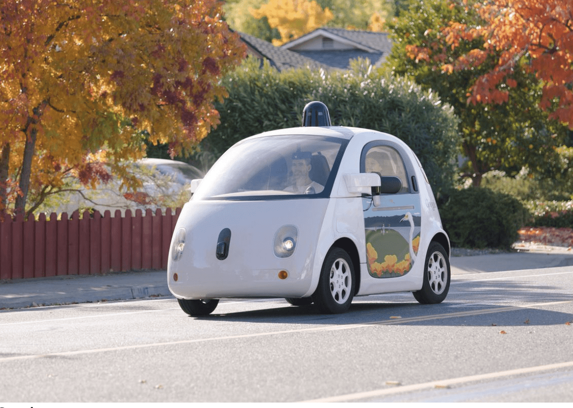
Google, in particular, recently unveiled details of its autonomous cars project. After testing it intensely inside the Google campus, the company is trying out the vehicle on public roads. Based on how the search engine giant is going about this project, it won’t be wrong to state that the road to realizing self-driving car nirvana isn’t far now! Let’s talk about some of the top technologies that are powering these autonomous cars by Google.
1. Front camera for closer vision
The car has a camera mounted on its windshield, enabling it to see the objects right in front. These could be anything ranging from motorists and pedestrians to stray animals. This camera also can detect and record information related to traffic lights and road signs, all of which get intelligently interpreted by its integrated software. Before moving on to the next point, here’s all the latest on this self-driving car project of Google.
2. Laser range finder
This constitutes the heart of Google’s autonomous car. Lidar is a rotating camera fixed on the car’s rooftop, which works like a laser range finder. The camera uses its 64 laser beams to create 3D images of all the objects surrounding the car, enabling it to detect any hazards along its path.
The distance of the object from the car is calculated based on the time taken by the laser beams to hit it and return to the car. Even more impressive is that these laser beams are highly intense enough to create images and calculate the distance of objects falling within a 200 m radius.
3. Radars mounted on the bumpers
The car’s rear and front bumpers are fitted with four radars that help it detect vehicles behind and in front. This technology is the same as the modern-day cruise control systems pre-fitted in cars. The radar sensor keeps a close digital watch on the vehicle ahead.
The programming of the software is done so that the car always maintains a 2 to 4-second distance (sometimes even more) at all times. Hence, this technology enables the car to slow down or speed up depending upon the driving behavior of the driver/car in front. Thus, use this technology to keep passengers and other motorists safe by avoiding bumps and crashes.
4. Geo-location reading by aerial
An aerial device fitted on the car’s rear constantly receives information from GPS satellites related to its precise current location. The GPS inertial navigation unit inside the car works hand-in-hand with these sensors, enabling the car to localize itself.
However, because GPS estimates can sometimes be way off (at least by many meters, thanks to signal disturbances and various other interferences), this data is constantly compared against the sensor map data obtained earlier from the same place. With the vehicle on the move, its internal map is regularly updated with the changing positional information.
5. Ultrasonic Sensors on the Rear Wheels
An ultrasonic sensor mounted on a rear wheel monitors the vehicle’s movements and alerts the system to obstacles. This technology is currently operational in several cutting-edge cars. Advanced vehicles equipped with ‘Reverse Park Assist’ use these sensors to navigate the vehicle into narrow parking spaces. These sensors are activated when the car is put into reverse gear.
6. Advanced Road Behavior Interpretation in Driverless Cars
The software has been meticulously designed to accurately interpret common road behaviors and driver signals. This sophisticated system operates various programs simultaneously within the car’s core, enabling it to navigate complex traffic scenarios and make informed real-time decisions safely.
For instance, if a pedestrian starts to cross the road, the driverless car promptly identifies the movement. It adjusts its speed to ensure safety. The car can distinguish between road users by utilizing predefined movement patterns and contextual cues, such as slower-paced motion and specific pedestrian shapes.
Conclusion
As the race toward autonomous vehicles intensifies, the realm of driverless cars is rapidly evolving. Giants like Google, Tesla, and Uber are at the forefront, unveiling groundbreaking technologies that power these futuristic automobiles. From front cameras for precise vision to laser range finders and advanced behavior interpretation systems, these vehicles are equipped with sophisticated sensors and software.
This technological marvel isn’t just about innovation; it’s about ensuring road safety and efficiency. These technologies, meticulously integrated into driverless cars, aim to interpret road conditions and respond intelligently, prioritizing safety and navigation through complex traffic scenarios. With each advancement, we inch closer to a world where cars navigate autonomously, transforming the landscape of transportation as we know it. The road to self-driving car nirvana may indeed be nearer than we think.


